
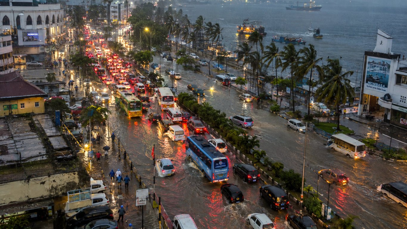
The Ministry of Health’s list of 21 high-risk counties reads like a Christmas travel itinerary. Mombasa, Kilifi and Kwale are on it. So are Nyeri, Murang’a, Meru, Kisii and Nyamira. If your December involves a drive to the coast or a drive home to the highlands, the El Niño hotspots in Kenya are the places you were already going.
Three Lists, One Map
Kenya has three official El Niño hotspot lists this year, and they overlap almost completely. On 11 August the National Disaster Operations Centre mapped the high-risk zones by hazard. Riverine flooding: Kisumu, Busia, Siaya, Homa Bay and Migori around the lake, with Tana River, Kilifi, Lamu, Mombasa and Kwale on the coast. Flash floods and landslides: Turkana, Baringo, West Pokot and Narok. Urban flooding: Nairobi, Mombasa and Kisumu. Garissa, Wajir and Mandera were listed for pastoral vulnerability.
The Kenya Meteorological Service Authority’s October to December outlook, issued on 26 August, names 18 counties at risk. Its list matches the disaster centre’s almost line for line. It carries the same three north-eastern counties for flooding rather than drought. The Ministry of Health’s advisory of 14 September puts all 47 counties on alert and names 21 as high risk. It adds the landslide highlands the other two leave out: Murang’a, Nyeri, Meru, Kisii and Nyamira, along with Kitui, Makueni and Machakos on the drive to the coast.
The forecast itself expects above-average rain over about 80 per cent of the country. Rain has already started in the west and the Rift Valley, Narok included. No dry break is expected before the season. Nairobi and the central highlands should see onset around the second week of October. The coast and the south-east follow in the third and fourth weeks. The Authority describes “prolonged wet spells” running into January, where a normal year’s short rains finish by mid-December. Mashujaa Day falls at onset. Jamhuri Day and Christmas fall inside the peak.
The Coast Run
The Nairobi to Mombasa corridor crosses more El Niño hotspots in Kenya than any other domestic route. Machakos, Makueni and Kitui are on the health ministry’s list. Mombasa, Kilifi and Kwale are on all three. In the last El Niño the coast took the heaviest rain in the country. The Authority’s State of the Climate 2023 report records Mombasa at 934.2 millimetres for October to December, 288 per cent of its long-term mean, and Lamu at 295 per cent.
The road record from that season is specific. On 25 November 2023 floods broke Mbogolo Bridge on the Mtwapa–Kilifi road. Traffic to Malindi and Watamu went round through Mazeras, Kaloleni and Mavueni. A higher replacement bridge reached completion works in 2025. Check with the Kenya National Highways Authority that it is open before you rely on it.
In Nairobi, Mombasa Road and Uhuru Highway flooded on 6 and 7 March 2026. Governor Johnson Sakaja’s county teams are clearing drains across all 17 sub-counties. Drainage works on Mombasa Road were still under way in mid-September. The highways authority has also inspected the Muthaiga–Kiambu, Kiambu–Limuru and Ndenderu–Kamandura sections and the Western Bypass for flood risk.
The Madaraka Express is the part of the coast run that held. During the May 2024 floods the parallel highway jammed for hours while the train kept running. Kenya Railways moved the night departure from 10 pm to midnight so passengers could reach the terminus. In an El Niño year the train is the plan, and the road is the backup.
The Trip Upcountry
The highlands people drive home to at Christmas carry the landslide risk. The health ministry is the only agency that names them. Murang’a, Nyeri and Meru are listed for landslide-prone areas. Kisii and Nyamira are listed as the Gusii Highlands. West Pokot appears on all three lists. Kisumu’s Kano Plains and Busia’s Budalang’i are named for riverine flooding. Budalang’i residents were already reporting rising rivers and lakes in mid-September.
The Mara adds two known failure points. The Kedong section of the Mai Mahiu–Suswa–Narok road closed for six days in March 2026 under floodwater and silt. In September, Narok leaders were pressing the highways authority to finish repairs before the rains. The Talek River burst its banks on 1 May 2024 and again in early March 2026, flooding riverside camps both times. Camps on higher ground and the Mara Triangle kept operating. The County Government of Narok charges citizens KES 3,000 a day at the reserve gate from July to December. A wet December visit costs double a wet March one.
One region sits outside the pattern. The Authority expects “poor to fair” rainfall distribution in Turkana and Samburu. It is the only part of the outlook below average. The disaster centre still lists Turkana for flash floods, because dry river channels fill fast. The north is drier on paper without being safe on the ground.
Four Checks Before a December Journey
The El Niño hotspots in Kenya sit on the coast counties, the highland home counties and the capital’s own arterial roads, which is where most of the country will be between 20 October and New Year. The practical response is short. Take the train to Mombasa and leave early for it. Confirm the Mbogolo crossing before a Malindi trip. Ask any Mara camp about the Talek. Give the highland drive a daylight start and an extra day. Kenya Geographic will keep this page current as the Authority updates the outlook. The companion piece on the Safiri Kenya blog, Kenya El Niño Travel Advice, explains the Indian Ocean reading that decides how wet the season gets.

Comment (0)