
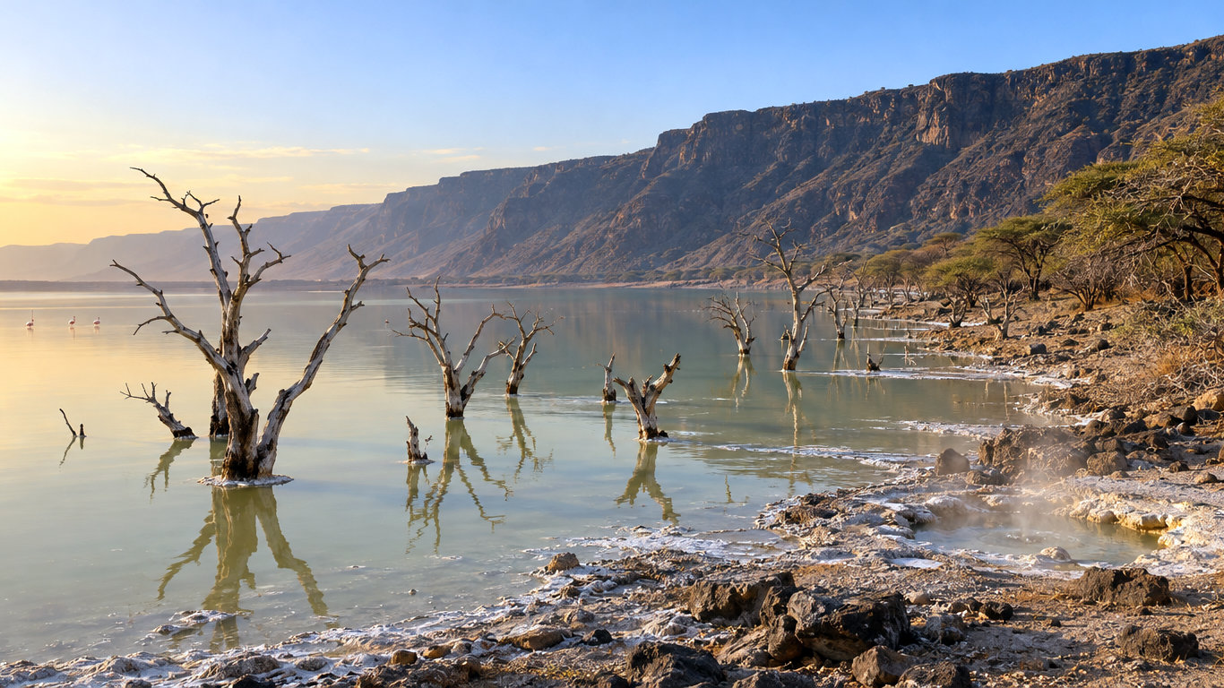
In November 2020, Lake Bogoria stood at 999.5 metres above sea level. A low saddle of ground just north of the lake sat 70 centimetres higher. Had the water risen that last 70 centimetres, alkaline water would have begun running north across the Loboi plain towards freshwater Lake Baringo.
The Distance Everyone Quotes Measures Different Things
The gap between Lake Baringo and Lake Bogoria is the most repeated figure in this story, and the news reports do not agree. NASA’s Earth Observatory said in 2020 that the lakes, once 20 km apart, were 13 km apart. AFP put the distance at about 10 km in August 2026. The same month, the Daily Nation reported that less than three kilometres now separate them. Among recent news figures, the largest is more than four times the smallest.
None of these reports says what was measured. It could be nearest shore to nearest shore, a straight line between lake centres, or the route water would follow. The research team that has studied the question most closely uses a third kind of figure. Their 2024 paper in the Journal of Hydrology: Regional Studies is led by Mathew Herrnegger of BOKU University in Vienna, with colleagues at BOKU, the Technical University of Kenya, Florida State University and Kampi ya Samaki on Lake Baringo. It puts the length of the potential watercourse between the lakes at about 17.5 km at 2020 water levels, and 33.2 km when both lakes were at their lowest. For the risk, a horizontal gap matters less than a vertical one.
Where Lake Bogoria Would Spill
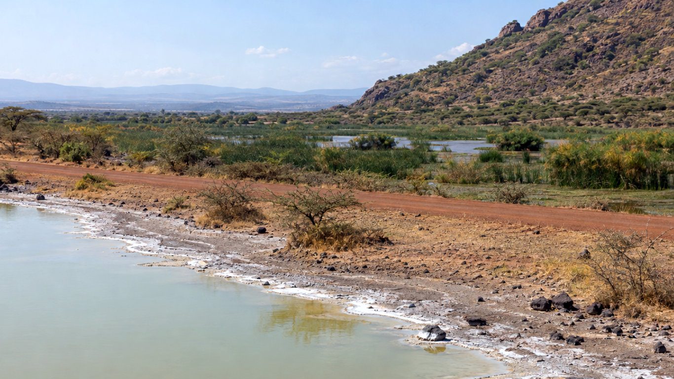
The Lake Bogoria overflow point sits 150 to 250 metres north of the lake and the new Loboi–Sandai road, at the foot of Baryat Hill, according to the 2024 study. The team surveyed it by drone. With trees and bushes removed from the elevation model, the lowest point on the divide came out at 1000.2 metres. Two satellite-based models gave 1001.3 and 1001.5 metres, and the drone model with the trees left in gave 1001.6. The authors judged 1000.2 metres the most realistic.
From 1984 to 2009 Lake Bogoria barely moved, staying between 993.1 and 994.0 metres. Then it climbed 5.7 metres to the November 2020 peak. By February 2023 it had dropped to 998 metres, 2.2 metres below the spill point. The last reading in the paper, from June 2023, was 997.9 metres.
If the lake did spill, the water would cross the Kiborkoch swamp into the Loboi swamp. There it would join existing channels, partly along the lower Molo River and past the Ng’arua swamp, before reaching Lake Baringo.
The paper estimates the odds of an overflow from the way the lake rose and fell in past years. From the 2020 peak, if the wet years since 2009 continued, the chance of reaching the spill point was 38 per cent within one year. Within five years it was 77 per cent. From the lower 2023 level the odds were far smaller: 0 per cent within a year, rising to 31 per cent within five. Under the drier long-term climate, the five-year figure falls to 12 per cent.
Why Lake Baringo and Lake Bogoria Would Not Become One Lake
Lake Baringo has its own low point to the north, the Lobat Gap, at about 990.5 metres. That is roughly 9.7 metres lower than Lake Bogoria’s spill point. On today’s ground, a Lake Baringo swollen by overflow would spill north towards the Suguta Basin long before its surface rose to meet Lake Bogoria’s. The authors call this reminiscent of conditions 8,000 to 10,000 years ago, when the two lakes were connected and drained north.
The realistic danger is a stream, not a merger, and the two waters are very different. The team measured Lake Bogoria’s electrical conductivity, a proxy for dissolved salts, at 33,800 microsiemens per centimetre. Lake Baringo measured 450 to 500, roughly seventy times less.
A Lake Bogoria overflow would first reach three freshwater swamps (Kiborkoch, Loboi and Ng’arua), then the lower Molo River and finally Lake Baringo. How far the alkaline water would be diluted on the way is uncertain, the authors write. The Loboi plain loses a great deal of water to evaporation, which could sharply cut how much arrives. They estimate that 6,000 to 25,000 people would be affected.
Kenya Wildlife Service senior warden Jackson Komen put the stakes plainly to AFP in August: “If the two lakes mix, then the fish, crocodiles and hippos may not survive.”
What Has Changed Since the Study
The study’s data stop in mid-2023, and no published level series for Lake Bogoria has appeared since. According to Herrnegger, the lake has risen again. In April 2026 he told Nature Africa that satellite altimetry showed it reaching the spill-point elevation in December 2025. An overflow may already have occurred, he said, though its extent was unclear until checked in the field. By August he was more direct. “The overflow is already happening,” he told AFP, adding that it was unclear how much water would reach Lake Baringo.
As of 24 October 2026, we have found no published field report confirming water moving from Lake Bogoria into the Kiborkoch swamp.
The cause of the 2010–2020 rise is better established. At Marigat, on the western edge of the Loboi plain, mean annual rainfall rose from 463 mm in 1986–2009 to 978 mm in 2010–2018. That is an increase of 111 per cent. There were fewer rainy days, but days of intense rain rose by 318 per cent.
The cost is already being paid on the shore. Nature Africa reported that the former Loboi health clinic has been inundated by Lake Bogoria. Jones Lewatchum told the same outlet he has moved his family three times since 2012 and now lives in a tent on a neighbour’s land. Michael Baimet, director of the local disaster department, told AFP that tourism earnings had dropped from about US$1 million a year to US$200,000.
Still Waiting for Ground Truth at Loboi
Two things would settle the next chapter of this story. One is a published or ground-measured water level for Lake Bogoria after June 2023. The other is someone standing at the spill point to see whether water is flowing north. The study’s authors also set out what can be done. They favour holding more water back in the catchments. They note that the ground at the spill point would suit a dam to raise it, but only after careful study of what that would mean for people and wildlife. We have found no official decision on such a dam.
Lake Bogoria is known for its flamingos and hot springs. In 2011 we asked whether it could be a new home for flamingos; fifteen years on, the question is where its water goes next. The full Lake Bogoria overflow study is free to read. We will return to Loboi when the spill point has been checked on the ground.

Comment (0)